This application offers a huge reference book with detailed descriptions of hundreds of different mushrooms and high-quality photos. Which of them can be eaten, where and when they grow, what they can be confused with - here are the answers to all the questions.
The main feature of the application is the ability to recognize a mushroom through a smartphone camera. For this purpose, neural networks are used, which at the output offer several most likely answer options. The function is experimental and cannot be trusted 100%, but the detection accuracy is very high.
2. Mushroom Picker's Guide
This directory app features a more modern interface and easy navigation. From the menu on the left you can quickly navigate to the edible and inedible sections. All of them are supplemented with several photos, a description and an indication of the season when they can be collected.
No less useful will be advice and articles that provide answers to many questions about poisonous mushrooms and possible poisoning. There is also a visual showing the seasonality of all mushrooms from the directory. With its help you can find out when is the best time to go to the forest.
3. Mushrooms
The simplest reference book, not overloaded with unnecessary information. There are only three sections in it: edible mushrooms, inedible and useful articles. For each mushroom, a description is available indicating other names, classification, nutritional qualities and other useful information.
The app has a favorites feature that makes it easier to access previously marked mushrooms, as well as notes. The latter allow you to leave your comment on any mushroom. Among other things, it is worth noting the function of changing the font and end-to-end search across all content.
4. Ecoguide - mushrooms and key
An extensive encyclopedia for iOS containing descriptions of more than 300 types of mushrooms. A guide that takes into account 24 morphological and ecological characteristics will help in recognizing them. There are also quite a few supporting articles and even various dishes. You can test your own knowledge using a special quiz.
All content of the application is available even without an Internet connection, however, in the free version, photos of mushrooms are shown only in black and white. To access color photographs you need to pay.
5. Mushrooms: a large encyclopedia
Another detailed guide with the function of recognizing mushrooms through a smartphone camera. As with any other similar application, no one guarantees absolute accuracy, but you can significantly narrow your search with its help.
Another interesting feature is the function of creating photo notes with saving coordinates. It allows you to create your own map of mushroom places for each year. It is also possible to save any articles from the database in the favorites list, so that the main thing always remains at hand.
This program will be very useful for mushroom pickers, hunters and fishermen, as well as for those who are afraid of getting lost while hiking. Precise instructions voiced in a pleasant voice will add a pleasant feeling when using this program.
Brief essence of the game
The user must get from one place to another, and the task of the “I'm going home” program is to simplify this task for him as much as possible. Many users believe that there are many such programs, but they are completely mistaken.

Nowadays there are a lot of different navigators, but they will only guide the user along paved roads. If you go mushroom picking, they will be of little use. A compass can also be an excellent assistant in such cases, but they are not entirely convenient to use.

The mushroom picker has to take out a compass, highlight it with his phone, check it, and put everything back in his pocket. But if he goes off course, the road may turn out to be much longer.

Game Features
It is worth noting that the “I’m going home” program will be very useful when going for a walk in the forest. A person needs to mark a point on the edge of the forest, after which his return home will be commanded by a program that will lead him back to the marked place.

When mushroom pickers have found a beautiful clearing and want to return here next weekend, “I’m going home” will do them a huge service. This is especially true when mushroom pickers are in this area for the first time. To return here again, you need to mark the coordinates of the clearing in the program.
Going to the forest to pick mushrooms is a traditional Russian pastime, in which knowledge and experience have always played an almost decisive role. Mushroom places were reported in great confidence by word of mouth, newcomers learned to identify mushrooms and walk through the forest under the guidance of “experienced” ones, and cooking recipes were passed down from generation to generation. Now, along with a knife, a basket and mosquito repellent, a smartphone has become one of the main attributes of lovers of quiet hunting. Non-greedy mushroom pickers post information about fertile clearings on social networks, and apps help them find, recognize, avoid getting lost, and preserve them. We have reviewed online services to make summer 2019 a mushroom ride for you.
Let's start with the basics
The application will help you study the theory of mushroom science "Mushroom Picker's Guide". The “Articles about Mushrooms” section contains everything from advice for novice mushroom pickers to recommendations on how to recognize mushroom poisoning and provide first aid.
Each mushroom is classified according to edibility and described in great detail - appearance, features, growing area.


In addition, a mushroom calendar is available in the application - the developers have included the ripening dates of each mushroom in a separate table, which is quick and easy to navigate.

Let's move on to practice
So, the theory has been studied, and now you can go into the forest, where getting lost is as easy as shelling pears. Moreover, not only beginners, but also experienced mushroom pickers are guilty of this. Every year, rescuers bring thousands of hapless, quiet hunters out of the forests of Russia. You can even lose your car in the forest - such cases happen quite often.
If you don’t have a navigator and your mushroom picking trip is not expected to be very far, try using the program "I'm Going Home Lite". The application starts a connection with GPS immediately after opening, and if a map of the area where you plan to move has already been downloaded, you can safely turn off the mobile Internet, thereby significantly reducing your smartphone’s battery consumption.
First you need to put a point where you enter the forest or, for example, where you leave your car. The application will give you the coordinates of this place and offer to rename the target for convenience.
Are you going to pick mushrooms with your family, but are you afraid of losing each other? You can find out the location of your loved ones and let them see where you are using the MTS Search service: everything is under control in your smartphones.
The track will begin to be written independently, and whether the smartphone screen is turned off does not matter. If you find a clearing with mushrooms, you can also mark this goal to return at any time (the points are stored in the program’s memory).

To get to the starting point, you just need to click on the corresponding point and follow the voice prompts. Well, or just watch on the screen so as not to deviate too much from the path laid out by the navigator. At the same time, at any moment you can see how much distance is left to the target and at what speed you are moving.


Expert in your pocket
If you are a beginner mushroom picker, then it is, of course, better to go with an experienced friend at first, who will tell you which mushrooms are edible and which ones you shouldn’t even touch. But if there is no such comrade, the smartphone will again come to the rescue. Application "Pick mushrooms" determines quite accurately which mushroom is in front of you. To do this, you can use both a mechanical method (by independently selecting the parameters of the mushroom) and automatic detection - using photos from the scene of events.
In reviews of navigators, namely in descriptions of application functions, the emphasis is most often placed on opportunities for motorists and for public transport. However, there are many people who use a navigator when walking. Don't forget about tourists, athletes, mushroom pickers, hunters and fishermen.
Unlike automobile routes, pedestrian routes often use not roads, but paths, sidewalks and other transportation options. Navigators from Google Play (for Android) and in the AppStore (for iOS) do not always offer optimized paths, being limited to highways.
Therefore, in the review we will focus specifically on the possibilities when building walking routes and will offer you suitable GPS navigators for mobile devices:
As you can see, the list of pedestrian navigators is small, but over time it will be expanded. Well, as always, you can download the mentioned navigators using the links under the application descriptions.
Google Maps – a walking navigator with support for offline maps
Google Maps is perhaps one of the best free navigators that fully supports the creation of walking routes. Moreover, in our latitudes, a separate application is often used for auto navigation - Navitel, but not Google Maps.
One way or another, the Google Maps mobile application is an excellent assistant for pedestrians and tourists who need to create a travel route and who have a smartphone. Let's note some pedestrian functions of the application:
How to create routes for pedestrians in the Google Maps application for Android (the Internet must be turned on):
- Indicate your destination on the map (by clicking on it) - the "Route" button.
- “Go” button – Icon with a picture of a person.
- My location is "Where". Instead of "Where", if necessary, set the destination point.
Google Maps application as a walking navigator (routing)
Google Maps will select the optimal walking route, taking into account the terrain, to follow. If there are several options, you can accordingly choose the one that is more suitable for pedestrian travel. Additionally, the distance, time to travel, in steps and with turns will be indicated.
The developers of the Android application note: the walking routes are in the testing stage (there may be inaccuracies and errors). However, when traveling on foot, this is not as fatal for the navigator as when driving quickly in a car, when the smartphone must respond quickly.
A nice bonus for users of the mobile version (Android/iOS) - the Google Maps application also works offline. This is a useful and often indispensable function for all kinds of hiking and hiking.
You can download a map and travel to different countries without worrying about an Internet connection. At the same time, it will not be possible to build a route without the Internet; you will have to navigate only by coordinates - that is, by a marker that is synchronized by GPS.
Summary. Google Maps is good as a pedestrian and tourist navigator around the world, but without the Internet the functionality will be limited - it will not be possible to plot the optimal route automatically.
You can download this pedestrian navigator from the link:
Yandex Navigator - navigator for walking routes in Russia and the CIS countries
In 2016, Yandex Navigator for Android and other platforms acquired many additional functions and, accordingly, became more adapted for pedestrians. Now the Yandex GPS application confidently builds routes - however, walking navigation is only available in Russia, Belarus, Ukraine and Kazakhstan.
Let's touch on the main functions of Yandex Navigator, useful in the context of the article:
- Creating routes for pedestrians with time and distance calculations
- Additional construction of alternative routes (auto, public transport) and comparison with the selected (active) route of movement
- The maximum distance for creating a route is 50 km, which is more than enough, although this may not be enough for cycling.
- Building a walking route between two houses on a smartphone
To build pedestrian routes, Yandex Navigator uses a grid of paths, paths, sidewalks - so the resulting navigation differs from highways. As developers from Yandex say, compiling such maps of pedestrian movements is quite difficult, and to finalize the maps, volunteers are used, current users of the navigator who participate in the creation of the so-called. people's map.
Like Google Maps, the Yandex Navigator application cannot plot walking routes without online access, while you can view maps and track your position without the Internet without any problems.
Summary. To summarize, we note that Yandex Navigator will be useful for pedestrians and tourists when used in the near abroad and neighboring countries. You can download this GPS app for iPhone, Android and Windows Phone.
Maps.me – pedestrian navigator for Android with detailed osm maps
Maps.me is another free navigator, suitable for motorists, cyclists and, of course, pedestrians. You can use this GPS navigator for hiking, building walking routes and tourism.
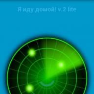
I'm going home! - a simple navigator for mushroom pickers and hunters
Many people do not like the overly broad and mostly unnecessary functionality of mobile navigators. And gadgets like Garmin are not very convenient for simple tasks and cost a lot of money.
Application "I'm going home!" Great for fishermen too, as it only has the most basic features for pedestrians. That is why this navigator is very popular, although it cannot compete in its capabilities with other applications. It’s very easy to use; you don’t need to download or configure anything. The application will be useful for older people who have difficulty with coordination.
The "I'm going home" navigator works very simply. First, you need to turn on navigation on your phone and wait for communication with satellites. It is clear that it is advisable to do this in an open area, so that nothing interferes with stable synchronization with the satellite.
Possibilities:
- Saving the starting coordinates on the map - the place where you will need to return (for example, to the car).
- Saving any points with names and descriptions on the map in any form.
- Plotting a route from current coordinates to a given point
- Work in passive mode with voice-over capability
The navigator does not require money (it displays advertising for this) and works in Russian.
Not everyone needs a full-fledged car navigator with a countless set of often unclaimed functions. Sometimes there is a need for the simplest and easiest voice navigation application that will simply allow a hiker or traveler to find their way to their starting point.
So, we bring to your attention an excellent application “I’m going home”, which simply must live in the smartphones of mushroom pickers, hunters, scouts, hikers and other people who often find themselves in forests or on unfamiliar rough terrain. Now you can be sure that you will never get lost.
You must understand that the main task of this navigator is to lead you to your starting point. The program is very simple, but copes with its purpose with a bang. There are no maps, compasses, or sensors. The main opportunity is to use voice prompts to correct the direction of movement of the smartphone owner to the starting point. At the same time, you must understand that the application will not guide you along the return route, but along the shortest path to your home (starting point). Therefore, if you see a quagmire or a cliff in front of you when returning, go around them. The program will not replace your eyes, but after going around an obstacle, it will again continue to lead you to the house in a straight line, adjusting the route. If necessary, you can use Google Maps - the application is compatible with them.
Price: Free
OPERATING PROCEDURE
The algorithm for working with the navigator looks something like this:
1. Launch the application
2. Turn on GPS
3. We are waiting to receive the coordinates of your current location (displayed in a gray window) - these will be the coordinates for returning
4. Press the menu button on the phone and select “Record” from the menu that appears.
5. Next, you will be asked to write down the coordinates as a word: for example, “Camp”. After that, click “Record and select”.
6. That’s it, now that the coordinates of the conditional “home” are entered into the smartphone, you can turn off the program or even the smartphone itself. Then, when you need to find the way to “home,” simply launch the navigator and press the green “Let’s go home” button.
It’s clear that you can enter a lot of such conditional “houses” into the program and then simply choose the one you need from them.

As you can see, “I’m going home” is an ideal navigator in its simplicity and necessary capabilities for mushroom pickers, berry pickers, hunters and hikers, which will not let you get lost. The program works on devices with Android version 2.1 and higher and support GPS navigation.
Installing the program is simple. Download the installation file with the .apk extension, upload it to your smartphone and start installing the application.